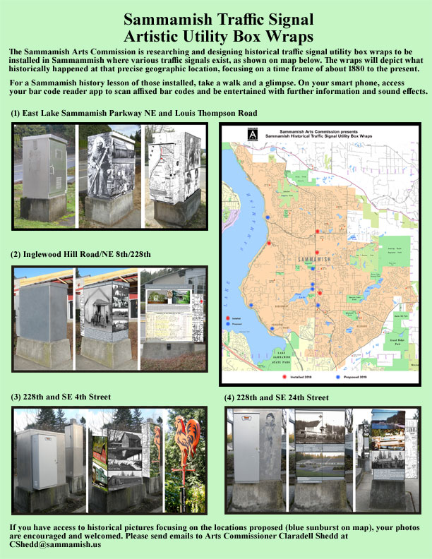
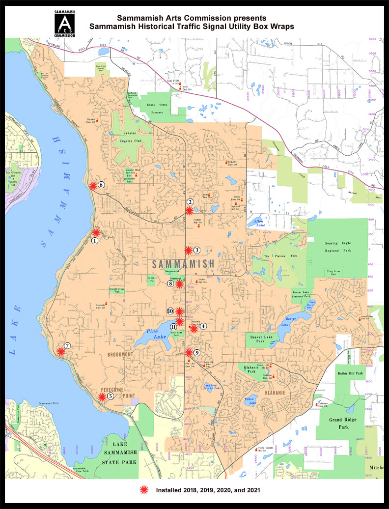
| Project-Utility Box Wraps; 2018-2021 | |||||||||||||||||||||
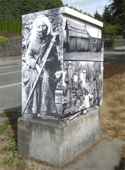
| Pictured below is the first installation completed in September 13, 2018. | |||||||||||||||||||||
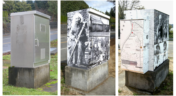
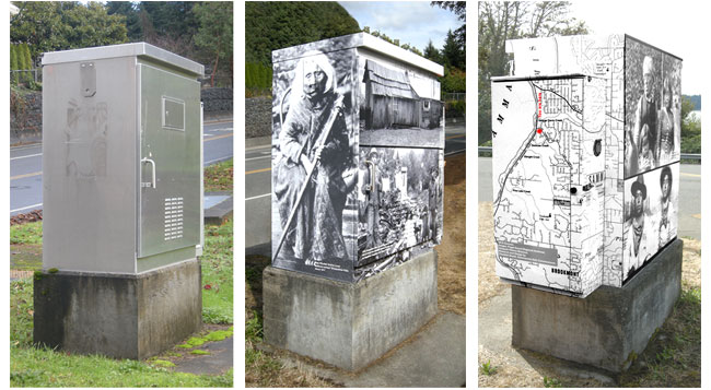
| Three Stages of Box; East Lake Sammamish
Parkway & Louis Thompson Road (drone 10/22/19: https://youtu.be/-VUO_x1V5iU ) |
|||||||||||||||||||||
 |
 |
 |
|||||||||||||||||||
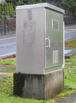
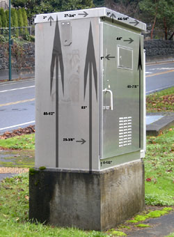
| East Lake Samm Pkwy PCab, Serv. | East Lake Samm Pkwy Measurements | East Lake Samm Pkwy West Elevation | |||||||||||||||||||
 |
|||||||||||||||||||||
 |
 |
 |
|||||||||||||||||||
| East Lake Samm Pkwy NE Elevation | Installation: September 13, 2018 | Installation: September 13, 2018 | |||||||||||||||||||
|
|||||||||||||||||||||
| A series of
articles is being written on each individual installation. (text submitted for the No. 1 Box Location appears below) |
|||||||||||||||||||||
| Article for Sammamish Neighbors Magazine
regarding installation at East Lake Sammamish Parkway NE and Louis Thompson
Road NE, Sammamish, WA . Appeared in January, 2019 issue. Wednesday, September 26, 2018 Sammamish remembers its roots… Our modern day Sammamish began creating roots for our community approximately
163 years ago with the 1855 Point Elliott Treaty In the Washington
Territory. East Coast residents made their treks toward the unexplored
and uncharted West Coast, lured by the Gold Rush in California (1948-1855)
and the Federal Homestead Act of 1862 (signed into law by Abraham
Lincoln on May 20, 1862). The Homestead Acts were several laws in
the United States by which an applicant could acquire ownership of
government land or the public domain, typically called a "homestead."
In all, more than 270 million acres of public land, or nearly 10%
of the total area of the U.S., was given away free to 1.6 million
homesteaders; most of the homesteads were west of the Mississippi.
Families made the covered wagon arduous journey via the Oregon Trail.
Those settling in California and Oregon extended their migration to
enter our present Washington State. Claimants (adult heads of families)
were required to "improve" the plot by building a dwelling
and cultivating the land, most often comprised of 160 acres of surveyed
public land. After five years on the land, the original filer was
entitled to the property, free and clear, except for a small registration
fee. Title could also be acquired after only a six-month residency
and minor improvements, provided the claimant paid the government
$1.25 per acre. After the Civil War, soldiers could deduct the time
they had served from the residency requirements. Of some 500 million
acres dispersed by the General Land Office between 1862 and 1904,
only 80 million acres went to homesteaders because few laborers and
farmers could afford to build a farm or acquire necessary tools, seed
and livestock. Native American tribal communities populating the Washington Territory
included Chinook, Duwamish, Muckleshoot, Sammamish, Skokomish, Snohomish,
Snoqualmie, Stillaguamish, Suquamish, Tulalip, Walla Walla, and Yakima.
Seasonal tribal residents worked in the hops fields, logging, and
coal mines. During the hop field harvesting, they were here. Most
tribal residents then walked back to their other communities as far
away as Yakima. Yes, they walked back! "In the end, our society will be defined not only by what we create, but by what we refuse to destroy." John Sawhill Claradell Shedd |
|||||||||||||||||||||
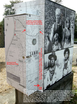
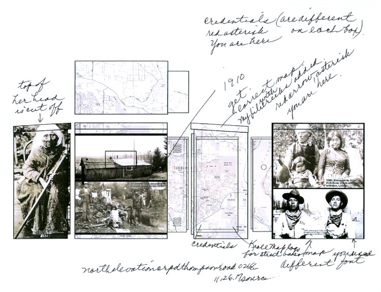
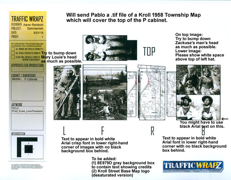
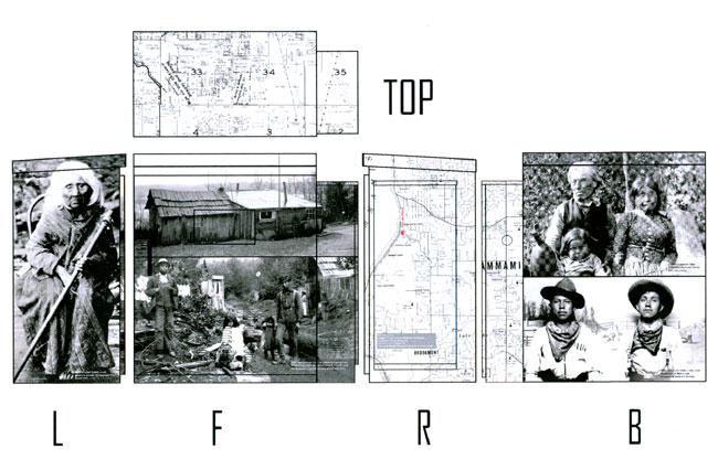
| Final Tri Graphic; East Lake Sammamish Parkway and Louis Thompson Road | |||||||||||||||||||||
 |
|||||||||||||||||||||
| Layout Proof; East Lake Sammamish Parkway NE and Louis Thompson Road | |||||||||||||||||||||
 |
|||||||||||||||||||||
 |
|||||||||||||||||||||
| Final Layout Proof; East Lake Sammamish Parkway NE and Louis Thompson Road | |||||||||||||||||||||
 |
|||||||||||||||||||||
| Below is the entry included in the 2018 Winter REC Guide of a Sammamish City Newsletter | |||||||||||||||||||||
 |
|||||||||||||||||||||
|
|||||||||||||||||||||
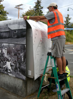
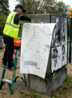
| NOTE: This project could not have been executed without the genuine and sincere efforts of the following employees at TrafficWrapZ: (1) Herb Kiekenapp, Global Director and local coordinator of all details, (2) Dan Gittere, VP of TrafficWrapZ, (3, 4, 5, 6) Aaron Reinbold, Pablo Marin, Latashia Benjamin, and Sara Segall, genius layout designers and publication experts, and (7, 8) Nick Nagel and Li Vara Plazas, indescribable exceptional installation artists. This is a professional privilege to experience how this organization listens, executes, and assures satisfaction of a quality product. | |||||||||||||||||||||
| Music: "Let There Be Peace" | |||||||||||||||||||||
| Home
| Locations
| No.1 Box | No.2
Box | No.3 Box | No.4
Box | No.5 Box | No.6
Box | No.7 Box | No.8 Box | No.9 Box | No.10 Box | No.11 Box | Harry Military | Sammi Award | Golf | Claradell Hall of Fame | Volunteer | Skates | Contact | Projects | City Council ©2023-csheddgraphics All rights reserved. All images and content are © copyright of their respective copyright owners. |
|||||||||||||||||||||